
Great Wilsey Park, Haverhill

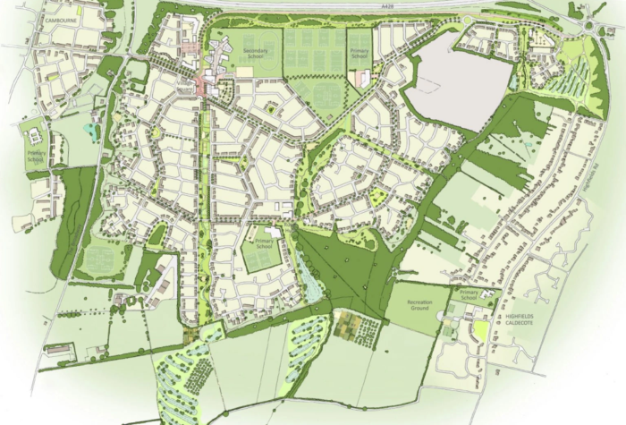
Great Wilsey Park is a major urban extension to the north-east of Haverhill, Suffolk. The scheme has outline consent for up to 2,500 new homes together with two primary schools, local centres with retail and community uses, employment space, healthcare, and a substantial country park and green infrastructure network. The site is being brought forward in phases, with housebuilders including Barratt and Redrow building out the early parcels following outline permission in 2018.
Our Role
Transport assessment and traffic modelling:
-
Multi-day automatic traffic counts at key locations in and around Haverhill, using data agreed and validated with Suffolk County Council.
-
Strategic and junction modelling to test peak-hour impacts of the full 2,500-home scheme and interaction with other committed developments such as North West Haverhill.
-
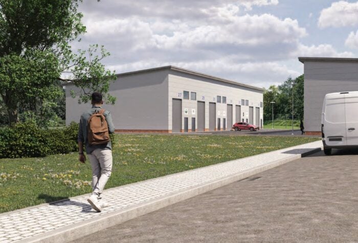
Detailed assessment of access strategy to the A143 and Chalkstone Way, ensuring safe operation and sufficient capacity for both general traffic and buses.
Brookbanks also engaged directly with stakeholders – presenting the transport evidence at public and Town Council meetings and addressing concerns around traffic flows and air quality.
2. Highway and junction design:
-
Primary access roundabout on the A143 and signalised access on Chalkstone Way, forming the main spine through the site.
-
The internal primary street network, ensuring suitable alignment, visibility and speed management consistent with manual for streets-type guidance.
-
Phasing and adoption strategy with Suffolk County Council to bring forward key junctions and links in a logical, fundable sequence.
The end goal was a network that could be adopted without drama, while still giving the housebuilders enough flexibility to refine internal layouts.
3. Flood risk and drainage:
Flood risk in this part of Haverhill is driven more by surface water and local drainage pathways than by direct fluvial risk, with the nearest significant floodplain associated with Stour Brook in the town centre.
Brookbanks developed a site-wide drainage strategy that:
-
Used the natural fall of the land to create a cascading wetland system at the heart of the scheme, stepping flows through a sequence of ponds and wetlands before discharge.
-
Embedded SuDS features – swales, basins and wetlands – into the linear park and green corridors, making water management a visible part of the landscape rather than a back-of-house engineering exercise.
-
Demonstrated robust attenuation for design storms with climate change, aligned with evolving LLFA expectations for storage and discharge control.
The LLFA specifically praised the design of the cascading wetland system, acknowledging both its technical performance and its contribution to the character of the country park.
4. Utilities strategy:
-
Potable water supply and reinforcement.
-
Foul drainage capacity and connection points compatible with the wider catchment strategy.
-
Electricity network upgrades to support the full 2,500-home build-out and community facilities.
-
Early provision for digital connectivity, aligning with emerging expectations for high-speed broadband in new communities.
The Outcome
1. Outcomes and benefits for the client.
The technical evidence Brookbanks prepared formed a core part of the Environmental Statement and supporting documentation that secured outline planning permission for up to 2,500 homes, schools, local centres and a country park in 2018.
For Hallam and CEG, that consent unlocked strategic land value and enabled a phased disposal and delivery strategy – with the first phase of around 900 homes sold to Barratt / Redrow soon after consent.
2. Low levels of off-site mitigation
By combining phased traffic modelling, up-to-date survey work and clear evidence around network performance, Brookbanks:
-
Demonstrated that the development impacts could be managed largely within or immediately adjacent to the site network.
-
Secured a low level of off-site highways mitigation relative to the size of the scheme, protecting viability and keeping the Section 106 / works package focused.
3. A drainage solution that adds value
The cascading wetland and integrated SuDS network did more than tick LLFA boxes:
-
It turned the central green spine and country park into a distinctive selling point for future residents, with visible water features and habitat.
-
It reduced reliance on hidden, heavily engineered underground infrastructure.
-
It attracted positive feedback from the LLFA, smoothing the route through planning and condition discharge.
For the landowners and housebuilders, this meant fewer redesigns, clearer approval pathways and a stronger place-making story.
4. Reduced planning risk through credible engagement
Brookbanks’ presence in public forums – including explaining transport data and methodology at Haverhill Town Council – helped the client navigate what could otherwise have been a highly contentious planning process.
Brookbanks:
-
Built confidence with officers and Members that concerns had been properly tested.
-
Kept the focus on evidence rather than speculation, which was critical in progressing the application to approval.
5. A delivery-ready technical framework
Because transport, drainage and utilities were all developed as part of a single, coordinated framework, housebuilders coming in behind the landowners received:
-
Clear access and junction parameters already accepted by the highways authority.
-
SuDS and drainage principles that slot neatly into the wider strategy without reopening fundamental questions.
-
Known utility corridors and capacity strategies to design around, reducing abortive work.
That has supported smooth progression of reserved matters applications and technical approvals for the early parcels.
Project Highlights
- Client: Hallam Land Management and CEG
- House builders Barratt and Redrow building
Sectors
Brookbanks Groups


Key Team Members

Senior Consultant – Utilities
Adam Melia
Read Profile
Principal Highways and Transportation Consultant
Andy Eggleston
Read Profile
Project Consultant – Flood Risk and Drainage
Katherine Peers
Read Profile
Group Director for Land, Development and Communities
Lee Witts
Read ProfileRelated Case Studies
Infrastructure|
Mixed-use|
Residential